
Matthias Stolz
DVW e.V.
Zur Person
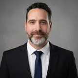
Hagi Ronen is the Director General of the Survey of Israel (SOI), the national authority for cadastre, geodesy and geospatial information in the State of Israel. He graduated from the Technion Israel Institute of Technology and previously served as Deputy Director General for Geodesy at the Survey of Israel. Throughout his career, he has led major national geospatial initiatives and promoted innovation, digital transformation and collaboration across government, academia and the private sector. Under his leadership, the Survey of Israel continues to advance the national geospatial infrastructure and develop innovative services for government, local authorities, businesses and the public.
Matchmaking-Informationen
Teilnahme


Diskussionsrunde "Digitale Souveränität"
From Challenges to Vision: Driving National Innovation Through a Collaborative Geospatial Ecosystem
Meine Veranstaltungen (2)
Datum
Veranstaltung
2.1.1 Digitale Souveränität
From Challenges to Vision: Driving National Innovation Through a Collaborative Geospatial Ecosystem
Health, and urban challenges, leveraging advanced geospatial data has become a critical strategic necessity. Mapping agencies today hold a central, pivotal position in tackling and addressing pressing national needs by transforming raw data into actionable insights for decision-makers. This presentation outlines the Survey of Israel's strategic vision for establishing a robust, collaborative geospatial ecosystem that seamlessly connects government ministries, local authorities, private vendors, and key partners. Ultimately, we will explore how this unified approach paves the way for future innovations, transforming national resilience and smart governance.
Souveränität // Sovereignty
Sprecher*in (1)
Matthias Stolz
DVW e.V.Moderator*in (1)
Daniel Kleffel
Präsident, Landesamt für Digitalisierung, Breitband und Vermessung (LDBV)Veranstaltung
2.1.1 Digitale Souveränität
Diskussionsrunde "Digitale Souveränität"
Sprechende (3)
Oliver Schrempel
Vizepräsident; CIO-VERM, Landesamt für Digitalisierung, Breitband und VermessungRudolf Staiger
Präsident, DVW e.V. - Gesellschaft für Geodäsie, Geoinformation und LandmanagementModerator*in (1)