
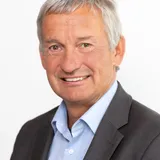
Jens Riecken
Abteilungsleiter, Bezirksregierung Köln - Geobasis NRW
Vorsitz Lenkungsausschuss Geobasis der AdV
About the Speaker/Moderator
Dr.-Ing. Jens Riecken studierte in Bonn und den USA mit anschließender Promotion in Bonn am Lehrstuhl für Astronomische und Physikalische Geodäsie. Das Technische Referendariat absolvierte er in Nordrhein-Westfalen. Er leitet heute die Abteilung „Geobasis NRW“ der Bezirksregierung Köln als die für die Landesvermessung zuständige Stelle in NRW. Seit 1998 vertrat er NRW in verschiedenen AdV-Arbeitsgruppen und Arbeitskreisen, zwischen 2017 und 2022 war er verantwortlich für den Arbeitskreis Raumbezug. Im Lenkungsausschuss Geobasis ist er Vorsitzender seit 2026. Er ist seit 2009 stellvertretender Leiter des Prüfungsausschusses Geodäsie und Geoinformation beim Oberprüfungsamt für das technische Referendariat. Von 2011 bis 2021 war er Lehrbeauftragter für die Vorlesung „Amtliche Kartographie“ an der Rheinischen Friedrich Wilhelms Universität Bonn und von 2009 bis 2022 Vizepräsident im DVW e.V., Gesellschaft für Geodäsie, Geoinformation und Landmanagement.
Matchmaking Information
Attending


Galileo Performance Differentiators

Panel Discussion: "GeoAI for Remote Sensing"
Bedeutung von Referenzdaten für die KI-gestützte Auswertung von Fernerkundungsdaten


Podiumsdiskussion: AdV „fit for future“


Award Ceremony

Vom Erfassen zu Ergebnissen: wo Daten zu Entscheidungen werden
Neue KI-Entwicklungen für die Fernerkundung

Capacity Development Project for Utilizing the National Geospatial Data Infrastructure in Ukraine

The PPP-RTK Satellite Positioning Service GEPOS® - Digital infrastructure for the federal administration and for Germany
Building the Future of Geospatial Data with Cloud Technologies
Speaker/Moderator's Sessions (13)
Date
Session
1.1.3 Positionale - Future of GNSS
The PPP-RTK Satellite Positioning Service GEPOS® - Digital infrastructure for the federal administration and for Germany
GNSS
Speaker (1)
Axel Rülke
Referatsleitung Satellitennavigation, Bundesamt für Kartographie und GeodäsieModerator (1)
Jens Riecken
Abteilungsleiter, Bezirksregierung Köln - Geobasis NRW, Vorsitz Lenkungsausschuss Geobasis der AdVSession
1.1.3 Positionale - Future of GNSS
Galileo Performance Differentiators
GNSS
Speaker (1)
Reinhard Blasi
Market Downstream and Innovation Manager, EUSPAModerator (1)
Jens Riecken
Abteilungsleiter, Bezirksregierung Köln - Geobasis NRW, Vorsitz Lenkungsausschuss Geobasis der AdVSession
1.1.3 Positionale - Future of GNSS
Award Ceremony
Sonstiges // Other
GNSS
Speakers (3)
Erich Kanngieser
Vorstandsvorsitzender, Nico Rüpke-StiftungBernd Krickel
Hauptdezernent, Bezirksregierung Köln – Abteilung „Geobasis NRW“Moderator (1)
Jens Riecken
Abteilungsleiter, Bezirksregierung Köln - Geobasis NRW, Vorsitz Lenkungsausschuss Geobasis der AdVSession
1.1.5 Smarte Geodaten
Smart Mapping: aktuelle Entwicklungen und Anwendungen
Smart Mapping betreibt eine zentrale und modular aufgebaute Entwicklungsplattform für eine schnelle, flexible und vollautomatische Erzeugung kartographischer Produkte der Vermessungsverwaltungen. Herbei steht die Ablösung bestehender Produkte der amtlichen Geotopographie im Vordergrund, aber auch innovative und neue Produkte werden umgesetzt, insbesondere im Bereich der Webkarten und Webdienste. Die dabei nun schrittweise entwickelten AdV-Standardprodukte werden unter der neu eingeführten Produktpalette mit dem Namen basemap.de veröffentlicht.
Neben Webkarten im Vektor- und Rasterbereich werden im selben Verfahren künftig auch maßstabsbezogene Präsentationsausgaben produziert, um den immer noch vorhandenen Bedarf an Druckausgaben zu decken. Die basemap.de P10 im Maßstab 1:10.000 wurde schon veröffentlicht, für die Ausgabe im Maßstab 1: 50.000 wird derzeit ein Prototyp entwickelt,
Das Kennzeichen von AdV-Standardprodukten aus Smart Mapping ist ein einheitliches Erscheinungsbild, einheitliche Nutzungsbedingungen, eine vollständige Abdeckung der Bundesrepublik und eine hohe Aktualität der Produkte. Das Verfahren kann durch seinen modularen Aufbau flexibel neue Datenquellen und neue Werkzeuge erschließen und sich so agil weiterentwickeln.
Amtliche Geobasisdaten und Standardprodukte dienen auch als Hintergrundinformation für beliebige Fachinformationen. Vor allem die basemap.de Web Vektor eignet sich hierfür, da diese ohne großen Aufwand an eigene Anforderungen angepasst werden kann. Bereitgestellt wird der Kartendienst über eine moderne VectorTile-Schnittstelle (API) zur einfachen Integration in beliebigen Anwendungen.
Im Rahmen dieser Präsentation werden der aktuelle Projektstand, die eingesetzte Technologie und künftige Ausrichtung von Smart Mapping vorgestellt.
Geodaten // Geodata
Speaker (1)
Vanessa von der Ohe
AG Smart Mapping, AdV c/o LDBV BayernModerator (1)
Jens Riecken
Abteilungsleiter, Bezirksregierung Köln - Geobasis NRW, Vorsitz Lenkungsausschuss Geobasis der AdVSession
1.1.5 Smarte Geodaten
ATKIS-1GEN – The Generalisation-Toolbox for Official Cartography
Geodaten // Geodata
Kartographie // Cartography
Speaker (1)

Christian Schubert
Dezernatsleiter, Hessisches Landesamt für Bodenmanagement und GeoinformationModerator (1)
Jens Riecken
Abteilungsleiter, Bezirksregierung Köln - Geobasis NRW, Vorsitz Lenkungsausschuss Geobasis der AdVSession
1.1.5 Smarte Geodaten
Building the Future of Geospatial Data with Cloud Technologies
Geodaten // Geodata
Speaker (1)
Elmar Happ
VertiGIS GmbHModerator (1)
Jens Riecken
Abteilungsleiter, Bezirksregierung Köln - Geobasis NRW, Vorsitz Lenkungsausschuss Geobasis der AdVSession
2.2.2 Geo-KI in der Fernerkundung
Neue KI-Entwicklungen für die Fernerkundung
KI // AI
Photogrammetrie / Fernerkundung // Photogrammetry and Remote Sensing
Speaker (1)
Christian Heipke
Institut für Photogrammetrie und GeoInformation, Leibniz Universität HannoverModerator (1)
Jens Riecken
Abteilungsleiter, Bezirksregierung Köln - Geobasis NRW, Vorsitz Lenkungsausschuss Geobasis der AdVSession
2.2.2 Geo-KI in der Fernerkundung
Bedeutung von Referenzdaten für die KI-gestützte Auswertung von Fernerkundungsdaten
Photogrammetrie / Fernerkundung // Photogrammetry and Remote Sensing
KI // AI
Speaker (1)
Andreas Müterthies
EFTAS Fernerkundung Technologietransfer GmbHModerator (1)
Jens Riecken
Abteilungsleiter, Bezirksregierung Köln - Geobasis NRW, Vorsitz Lenkungsausschuss Geobasis der AdVSession
2.2.2 Geo-KI in der Fernerkundung
Panel Discussion: "GeoAI for Remote Sensing"
KI // AI
Photogrammetrie / Fernerkundung // Photogrammetry and Remote Sensing
Speakers (2)
Christian Heipke
Institut für Photogrammetrie und GeoInformation, Leibniz Universität HannoverAndreas Müterthies
EFTAS Fernerkundung Technologietransfer GmbHModerator (1)
Jens Riecken
Abteilungsleiter, Bezirksregierung Köln - Geobasis NRW, Vorsitz Lenkungsausschuss Geobasis der AdVSession
2.1.5 Digitale Innovationen in der Industrie und Verwaltung
Digital data of the underground – information and interpretation. Measurements and modelling as a basis for analyses of alternative concepts of infrastructure projects and their effects.
BIM / Scan2BIM / InfraBIM
Speakers (2)

Manuel Aukenthaler
Senior Marketing Manager, Civil, Seequent
Peter Rummel
Director Infrastructure Poliy Advancement, Bentley Systems Germany GmbHModerator (1)
Jens Riecken
Abteilungsleiter, Bezirksregierung Köln - Geobasis NRW, Vorsitz Lenkungsausschuss Geobasis der AdVSession
2.1.5 Digitale Innovationen in der Industrie und Verwaltung
Vom Erfassen zu Ergebnissen: wo Daten zu Entscheidungen werden
Reality-Capture-Workflows entwickeln sich weiter. Entscheidend ist heute weniger, wie Daten erfasst werden, sondern wie sie Entscheidungen unterstützen. Hochwertige Reality-Capture-Daten bilden die Grundlage. Menschen bringen Kontext, Fachwissen und Zielsetzung ein, und durch Entscheidungen wird aus Erkenntnissen konkretes Handeln. In dieser Präsentation geht es darum, wie Fachleute Prozesse beschleunigen, indem sie Daten teamübergreifend zugänglich und nutzbar machen. Echte Kundenbeispielen zeigen, wie vernetzte Workflows Effizienz, Zusammenarbeit und Entscheidungsprozesse verbessern – mit Lösungen, die den Weg von der Erfassung zu Ergebnissen beschleunigen.
Reality Capturing // Extended Reality
Speakers (2)
Gianni Patri
Leica GeosystemsPhilipp Strahl
Product Engineer, Leica Geosystems AGModerator (1)
Jens Riecken
Abteilungsleiter, Bezirksregierung Köln - Geobasis NRW, Vorsitz Lenkungsausschuss Geobasis der AdVSession
2.1.5 Digitale Innovationen in der Industrie und Verwaltung
Capacity Development Project for Utilizing the National Geospatial Data Infrastructure in Ukraine
Trends und Entwicklungen in der Geoinformationsverwaltung // Trends and Developments in Geoinformation Management
Speaker (1)
Dmytro Makarenko
Chairman, State Service of Ukraine for Geodesy, Cartography and CadastreModerator (1)
Jens Riecken
Abteilungsleiter, Bezirksregierung Köln - Geobasis NRW, Vorsitz Lenkungsausschuss Geobasis der AdVSession
3.1.1 Podiumsdiskussion „AdV-fit for future!“
Podiumsdiskussion: AdV „fit for future“
Die deutsche Vermessungs- und Geoinformationsverwaltung hat mit der Bereitstellung von aktuellen, genauen und flächendeckenden Angaben über unseren Lebensraum und damit über das Gebiet der Bundesrepublik Deutschland eine zentrale Aufgabe des Staats übernommen. Hierzu gehört besonders der flächendeckende Nachweis aller Liegenschaften im Liegenschaftskataster. Zusammen mit der Bereitstellung des einheitlichen Raumbezugs, der geotopographischen Informationen der Bundesrepublik Deutschland sowie dem Schaffen von Transparenz auf dem Grundstücksmarkt und dem Betrieb der Geodateninfrastruktur kommt diesem Aufgabenbereich ein grundlegender gesellschaftlicher Stellenwert und Infrastrukturbeitrag des Staates zu.
In der Podiumsdiskussion soll aufgezeigt werden, wie sich die AdV „fit for future“ aufstellt und welche Herausforderungen auf sie zukommt. Dabei werden auch Ergebnisse der von der GDI-DE gemeinsam mit der Frankfurt University of Applied Sciences erstellten Nutzer- und Bedarfsanalyse vorgestellt.
Trends und Entwicklungen in der Geoinformationsverwaltung // Trends and Developments in Geoinformation Management
Speakers (5)
Ulrich Gellhaus
Direktor Landesamt GeoInformation Bremen, Vorsitz, Arbeitsgemeinschaft der Vermessungsverwaltungen (AdV)Stephan Heitmann
stellv. Referatsleiter, Ministerium des Innern des Landes Nordrhein-Westfalen (NRW)Moderator (1)