
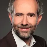
Andreas Müterthies
EFTAS Fernerkundung Technologietransfer GmbH
About the Speaker/Moderator
As head of the Business Development department at EFTAS Fernerkundung Technologietransfer GmbH, Dr Müterthies is involved in the development of processes for deriving and updating geoinformation from aerial and satellite images. In particular, his work focuses on the development of processes for the automatic extraction of information from image data to update environmental information. Since 2016, he has been Vice President of the German Umbrella Organisation for Geoinformation (DDGI e.V.) and Coordinator of the Copernicus Commission of the DDGI.
Matchmaking Information
Attending
2.2.4 Erdbeobachtung: Krisen


Effiziente Krisenbewältigung mittels Erdbeobachtung und innovativer Technologie - Praxisbericht des BKG
2.2.2 Geo-KI in der Fernerkundung

Bedeutung von Referenzdaten für die KI-gestützte Auswertung von Fernerkundungsdaten
2.2.4 Erdbeobachtung: Krisen

Protecting critical GNSS infrastructure: A multi-layered defence against intentional and natural threats
2.2.4 Erdbeobachtung: Krisen
The Geography of Violence: Remote Sensing for the Analysis of Flight, Displacement, Armed Conflicts and Wars
2.2.2 Geo-KI in der Fernerkundung
Panel Discussion: "GeoAI for Remote Sensing"
Speaker/Moderator's Sessions (5)
Date
Session
2.2.2 Geo-KI in der Fernerkundung
Wednesday, Sep 16, 2026
11:20 AM - 11:40 AM | Europe/Berlin
Vortrag // Presentation
INTERGEO Conference | Room C 54
German
Bedeutung von Referenzdaten für die KI-gestützte Auswertung von Fernerkundungsdaten
Photogrammetrie / Fernerkundung // Photogrammetry and Remote Sensing
KI // AI
Speaker (1)
Andreas Müterthies
EFTAS Fernerkundung Technologietransfer GmbHModerator (1)
Jens Riecken
Abteilungsleiter, Bezirksregierung Köln - Geobasis NRW, Vorsitz Lenkungsausschuss Geobasis der AdVSession
2.2.2 Geo-KI in der Fernerkundung
Wednesday, Sep 16, 2026
11:40 AM - 12:00 PM | Europe/Berlin
Podiumsdiskussion // Panel discussion
INTERGEO Conference | Room C 54
English
Panel Discussion: "GeoAI for Remote Sensing"
KI // AI
Photogrammetrie / Fernerkundung // Photogrammetry and Remote Sensing
Speakers (2)
Christian Heipke
Institut für Photogrammetrie und GeoInformation, Leibniz Universität HannoverAndreas Müterthies
EFTAS Fernerkundung Technologietransfer GmbHModerator (1)
Jens Riecken
Abteilungsleiter, Bezirksregierung Köln - Geobasis NRW, Vorsitz Lenkungsausschuss Geobasis der AdVSession
2.2.4 Erdbeobachtung: Krisen
Wednesday, Sep 16, 2026
3:00 PM - 3:20 PM | Europe/Berlin
Vortrag // Presentation
INTERGEO Conference | Room C 54
German
The Geography of Violence: Remote Sensing for the Analysis of Flight, Displacement, Armed Conflicts and Wars
Modern remote sensing from space, which today offers spatial resolutions of up to 15 cm and, in principle, daily repeat rates, makes it possible to document changes to the Earth’s surface with a high degree of precision. This makes it possible to document the spatial manifestations of developments such as armed conflicts, refugee camps, population and settlement trends in border regions, the demolition of informal slum areas and similar phenomena. This lecture will highlight and critically examine the technological potential, risks and ethical concerns associated with this technology.
Photogrammetrie / Fernerkundung // Photogrammetry and Remote Sensing
Erdbeobachtung und Satellitenanwendungen // Earth Observation and Satellite Applications
Speaker (1)
Hannes Taubenböck
Abteilungsleiter DLR und Lehrstuhlinhaber, Deutsches Zentrum für Luft- und Raumfahrt (DLR) OberpfaffenhofenModerator (1)
Andreas Müterthies
EFTAS Fernerkundung Technologietransfer GmbHSession
2.2.4 Erdbeobachtung: Krisen
Wednesday, Sep 16, 2026
3:20 PM - 3:40 PM | Europe/Berlin
Vortrag // Presentation
INTERGEO Conference | Room C 54
English
Effiziente Krisenbewältigung mittels Erdbeobachtung und innovativer Technologie - Praxisbericht des BKG
Erdbeobachtung und Satellitenanwendungen // Earth Observation and Satellite Applications
Speaker (1)
Martin Lenk
Abteilungsleiter, Bundesamt für Kartographie und GeodäsieModerator (1)
Andreas Müterthies
EFTAS Fernerkundung Technologietransfer GmbHSession
2.2.4 Erdbeobachtung: Krisen
Wednesday, Sep 16, 2026
3:40 PM - 4:00 PM | Europe/Berlin
Vortrag // Presentation
INTERGEO Conference | Room C 54
English
Protecting critical GNSS infrastructure: A multi-layered defence against intentional and natural threats
The integrity of the Global Navigation Satellite System (GNSS) is increasingly threatened by intentional and unintentional disruptions, particularly jamming and spoofing. Such attacks are on the rise globally, degrading or preventing positioning using GNSS observations and impacting critical applications that rely on high-precision RTK and PPP methods.
In addition, we are still experiencing the effects of the 11-year solar cycle. High ionospheric activity caused by the solar cycle disrupts GNSS signals and poses a significant challenge for surveyors.
Learn how to protect your GNSS infrastructure from jamming and spoofing through a comprehensive, multi-layered defense architecture. We will show you practical strategies to ensure you can rely on GNSS systems even during severe interference. You will also discover how to mitigate the impact of high solar activity using Trimble technologies. We will present data and analyses on how to effectively monitor your equipment, minimize downtime, and sustainably increase your productivity—despite atmospheric disturbances.
Erdbeobachtung und Satellitenanwendungen // Earth Observation and Satellite Applications
GNSS
Speaker (1)
Martin Janousek
Strategic Product Marketing - Real-Time Networks and Services, Trimble Germany GmbHModerator (1)