
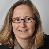
Nicole Ruhe
Leitende Regierungsvermessungsdirektorin
Landesamt für Vermessung und Geoinformation Schleswig-Holstein
About the Speaker
Nicole Ruhe - LVermGeo SH, Mercatorstr. 1, 24106 Kiel, Internet: www.LVermGeoSH.schleswig-holstein.de
Geburtstag: 10.10.1970, Geburtsort: Dinklage in Niedersachsen
Studium: 1990-1998 Studium der Geodäsie (Vertiefungsrichtung Photogrammetrie) an der Universität in Hannover - Diplom als Vermessungsingenieurin
Referendariat: 1996-1998 Techn. Referendariat an der Bezirksregierung Braunschweig in Niedersachsen - Assessorin des Vermessungswesens
Beruf:
12.1998-02.1999 Bezirksregierung Braunschweig in Niedersachsen, Dipl-Ing Vermessung "Aufbau eines GIS für Bodenrichtwerte"
02.1999 - 12.2010 Landesvermessungsamt Schleswig-Holstein, Dezernatsleitung "Geodaten-Service" und stellv. Abteilungsleitung für Allgemeines und Kartographie
01.2011 - 02.2022 Landesamt für Vermessung und Geoinformation Schleswig-Holstein, Leitung Koordinierung "INSPIRE, GDI, AAA-Integration"
01.2014 zusätzlich stv. Amtsleitung des LVermGeo SH
seit 03.2022 Landesamt für Vermessung und Geoinformation Schleswig-Holstein, Abteilungsleitung "Geodateninfrastruktur und Geodatenintegration" & stv. Amtsleitung des LVermGeo SH
aktuelle Gremientätigkeit: Lenkungsgremium GDI-SH, AG Ansprechpartner GDI-DE, Lenkungsausschuss Geoverfahren - Geobase4all, Mitglied im AdV-Arbeitskreis Informations- und Kommunikationstechnik, Prüferin im Oberprüfungsamt technisches Referendariat
Mitglied im Berufsverband des DVW und der DGfK
Matchmaking Information
Attending


Geobase4ALL – Development Initiative for Digital Sovereignty Through Federal Software Infrastructures – Workshop Report –
Speaker's Sessions (1)
Date
Session
3.1.2 Geobasis Next Level
Geobase4ALL – Development Initiative for Digital Sovereignty Through Federal Software Infrastructures – Workshop Report –
Trends und Entwicklungen in der Geoinformationsverwaltung // Trends and Developments in Geoinformation Management
Geodaten // Geodata
Speaker (1)
Nicole Ruhe
Leitende Regierungsvermessungsdirektorin, Landesamt für Vermessung und Geoinformation Schleswig-HolsteinModerator (1)